

Sheard, and 5 co-authors, released this report in 2008. The report is a guide designed to assist mineral explorers working in the regolith-dominated terrains of the central region of the Gawler Craton in South Australia: in particular those areas of weathered bedrock where dominantly terrestrial deposits form a patchy and comparatively thin (< 100 m) cover. From a mineral industry perspective, the Gawler Craton is renowned as host to the world-class Olympic Dam Cu–Au–U deposit. For exploration, the fertility of the Craton is confirmed by the recent discovery of a cluster of deposits and occurrences of Fe-oxide–Cu–Au (IOCG)-style mineralisation: mostly below thick sediment cover along the Craton’s eastern margin. The central region of the Craton is largely under-explored.
Before the 1990s, the only substantial metal production was 2.4 tonnes of Au from the Tarcoola Goldfield – discovered in 1900 – and from smaller workings at Glenloth and Earea Dam. Exploration over the past 20 years has identiï¬ed signiï¬cant resources of hypogene and intrusion-related Au, heavy mineral sands and Fe ore, and established the region as prospective for Pb–Zn, Cu–Au, Ni and sandstone-hosted U deposits. This Guide provides an introduction to the regolith and landscape history of the region, together with advice on strategies and methods that can assist with exploration for mineral deposits within, or beneath, the regolith.
The area covered by this Guide incorporates about half the recorded extent of exposed or thinly-covered crystalline basement rocks of the Gawler Craton, and includes cover sequences of largely undeformed intracontinental basin sediments that range in age from Mesoproterozoic to Neogene. All are variably weathered, and much of the geological detail is hidden by a veneer of sand that reflects the change to arid climatic conditions since the Late Pliocene – around 2.4 million years ago. The crystalline basement consists of Archaean to Mesoproterozoic metasedimentary rocks, volcanics and granitoids, and has been tectonically stable – apart from minor near-surface tectonic movements – for about 1450 Ma. Basement rocks record crust formation and tectonothermal events in the late Archaean to early Palaeoproterozoic (Sleaford Orogeny ~2440 Ma), Palaeoproterozoic (Neil Event and Kimban Orogeny 1845- 1700 Ma), and Palaeoproterozoic to Mesoproterozoic (Kararan Orogeny 1650–1540 Ma).
Details of the basement geology have been derived mostly from regional airborne magnetic surveys that deï¬ne structural and lithological trends. The magnetic data – together with regional geological mapping, geochronology, isotope analyses and geochemistry – have been used to subdivide the basement into a series of domains that are thought to represent major crustal components that were assembled during polyphase tectonic events during the Proterozoic (~1850–1540 Ma).
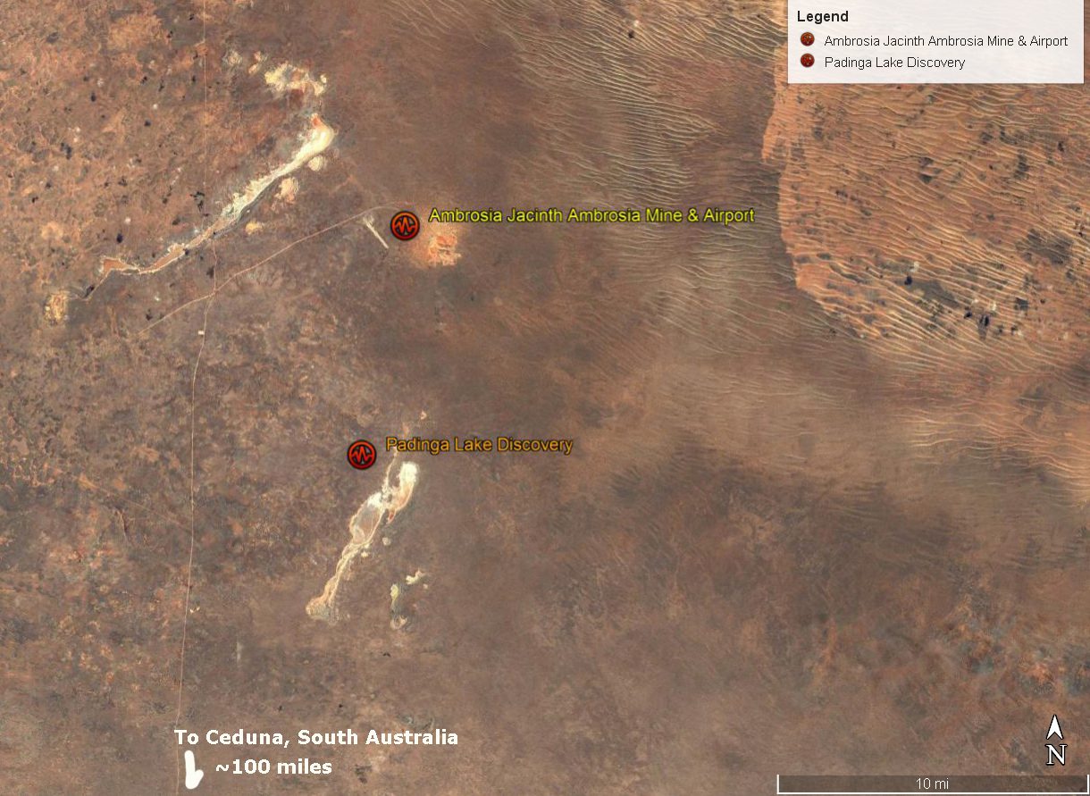
Recent discovery of high-grade Au at Challenger and world-class zircon deposits at Jacinth and Ambrosia confirm the presence of significant shallow mineralization, concealed by widespread regolith cover, on the central Gawler Craton. Although regolith cover impedes mineral exploration in the region, it is also an opportunity in that easily accessible deposits have remained hidden to earlier exploration. As mineralization models are developed for the new discoveries, further deposits will be found. Extracting maximum information from the regolith and developing techniques to ‘see’ within and through the regolith are strategies that will improve the likelihood of exploration success.
This Guide summarizes aspects of the regolith for mineral exploration and provides an introduction to techniques likely to be effective in discovery in the region. Refinement of techniques will come with increased uptake and application, exploration demands and knowledge derived from development of deposits. In particular, mapping out the palaeodrainage in greater detail will highlight areas of shallow basement that are largely unexplored and where additional techniques are needed to detect mineralisation below the channel sediments. The discovery of economic U mineralisation in channel sands will escalate the demand for new data on the distribution of channel networks. Refinement of geochemical surveys in areas of widespread dune and sand-plain cover will assist with rapid assessment of structures in bedrock: in particular, those structures identified from airborne geophysics as potential conduits for hydrothermal fluids.
Airborne hyperspectral surveys can map aspects of hydrothermal alteration in saprolite/bedrock outcrop with the margins of the GRV being a prime exploration target. Improved models that relate alteration mineralogy to preferred sites of mineral deposition will develop from the mass of new data generated from routine spectral logging of drill hole samples and multi-element geochemistry. Landscape evolution models and developing ideas on neotectonics underpin innovative approaches to exploring for minerals in the cover sediments. Integrating regolith knowledge with other aspects of mineral exploration approaches and techniques has proved to be an effective strategy–leading to new mineral discoveries in the region–and this will undoubtedly continue to be so for future exploration.
[Interesting Note: A zircon deposit was developed into a mine within a few miles north of where in 1969 Mr. Campbell discovered very high radioactivity and a light-green radium mineral in the nearby Pidinga dry lake beds. See (here). Google Earth locations of mine and discovery (more).]
Managed & Built by I2M Consulting, LLC | © 2010-
