

Drenth and Grauch report that the U.S. Geological Survey (USGS) has recently completed an assessment of existing, publicly available aeromagnetic data for the United States to identify and prioritize areas that need better coverage. We developed a system for ranking the available data using current best practices, and we created a map that summarizes the current coverage in the United States.
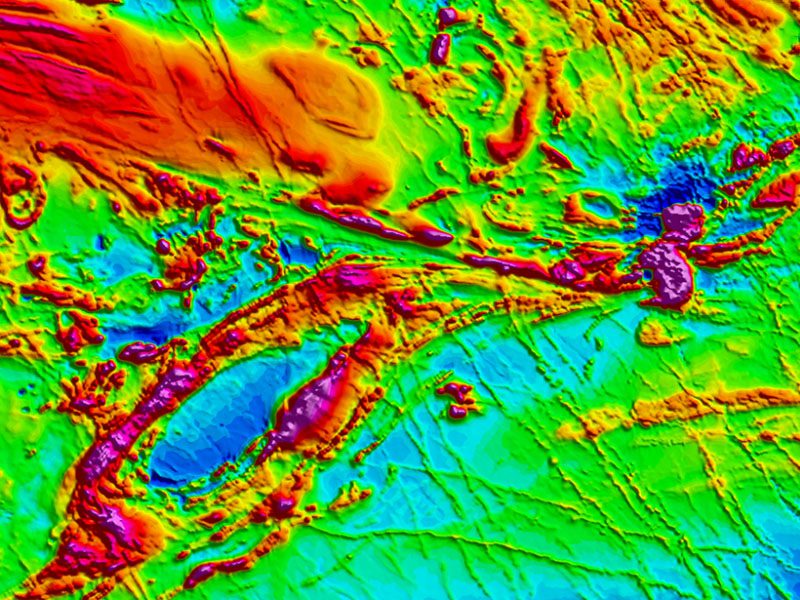
The U.S. public aeromagnetic data program is managed by the USGS, the agency that acquires, stores, and serves most of these data. The USGS was an early pioneer in aeromagnetic surveys and has been acquiring aeromagnetic data since the 1940s. However, the USGS has been unable to replace older, inadequate data with modern surveys. Instead, legacy analog data have been digitized, surveys that have inadequate sampling have not been replaced, modern surveys have been acquired only over postage stamp–sized areas (generally <2,000 square kilometers), and these disparate data sets have been merged without the ability to standardize the data to common parameters. As a result, high-quality public aeromagnetic data do not exist for most of the United States, placing the country behind much of the rest of the world.
Just how inadequate is the U.S. aeromagnetic coverage? The authors recently developed an assessment, or ranking, methodology that considers modern best practices for acquisition of aeromagnetic data, common practices in the past, and the suitability of the data to support geologic mapping and other research activities. They ranked the quality of existing aeromagnetic surveys and the corresponding data with respect to three categories: data type, survey specifications, and data issues. The three categories were ranked separately for each survey; then an overall rank was assigned on the basis of the poorest category rank, with 1 being the best and 5 being the worst.
A group of USGS experts applied the ranking scheme to every public aeromagnetic data set in the United States to assess the quality of existing aeromagnetic data coverage. This analysis is a national-scale, first-approximation evaluation to be reexamined in detail as future research priorities dictate. The resulting map (Figure 3) reveals that most of the United States requires updated, high-resolution aeromagnetic data.
The need to improve the nation’s aeromagnetic data has recently taken on greater urgency. Executive Order 13817, “A Federal Strategy to Ensure Secure and Reliable Supplies of Critical Minerals,” implemented by Department of the Interior Secretarial Order 3359, “Critical Mineral Independence and Security,” directs the USGS to develop a plan to improve the nation’s understanding of domestic critical mineral resources. Key parts of the plan include assessing and improving the quality of the nation’s geologic mapping, topographic data, and airborne geophysical data, particularly aeromagnetic data.
So what now? Although efforts to create better databases of existing public data have been largely successful [Finn et al., 2001], past attempts to promote a nationwide, systematic collection of modern aeromagnetic surveys have not gained traction [Hildenbrand and Raines, 1990; U.S. Magnetic-Anomaly Task Group, 1995]. The new executive and secretarial orders may spur an effort to acquire rank 1 aeromagnetic surveys across the United States, now in the planning stages at the USGS.
Managed & Built by I2M Consulting, LLC | © 2010-
