

Bersch presented a N 43-101 report to Max Resource Corporation dated March 5 2008. was engaged to undertake an independent review of the
exploration work on the C de Baca uranium project. The C de Baca project area consists of 108 unpatented load mining claims, the DAT claims, covering Sections 21, 22, and 23 of Township 1 North, Range 4 West, New Mexico principal meridian and baseline, Socorro County, New Mexico, USA.
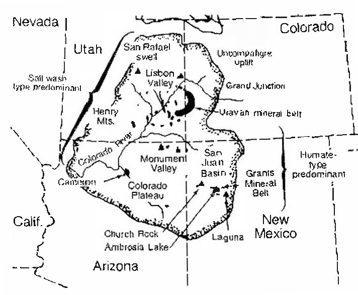
From Rackley (1976)
Ownership of the claim block is 100% Max Resource. Access to the property is good via unpaved improved dirt road from Magdalena, New Mexico. The operating season is year round with climate being typical intermontane high desert of the southwestern United States.
The project is in the Baca Basin which stretches for about 120 miles (193 km) from eastern Arizona to central New Mexico. The basin began forming in Late
Cretaceous time with deposition of the Crevasse Canyon Formation, followed by deposition of the Tertiary Baca Formation. The Baca Formation consists of
gently tilted (approximately 5º) fluvial sandstones, shales, and conglomerates.
The Baca Formation is informally divided into three units: Upper Red, Middle Gray, and Lower Red. All known mineralization on the C de Baca project is in the Middle Gray unit of Baca Formation. Most mineralization is within 200 – 300 feet (60 – 90 m) of the surface. The exact character of the mineralization is
unknown.
Uranium Mineralization was first discovered in the Baca Basin in 1953 in the Datil Mountain area about 25 miles (40 km) west of the C de Baca project. Since that time numerous uranium exploration programs have taken place within the basin. Leonard Resources, in 1974, acquired approximately 20 square miles (about 5200 hectares) in the eastern Baca Basin which included the area of the C de Baca project. Leonard joint ventured the project with several former major uranium explorers: SOHIO, Anaconda, Cominco American, and Occidental Minerals.
Drilling found significant uranium intercepts clustered in the NW quarter of Section 22, and NE quarter of Section 21, T.1 N., R.4 W. Occidental Minerals reported “geologic reserves of 500,000 pounds” for an area in the NW corner of Section 22 and the NE corner of Section 21, T.1 N., R.4 W. The methodology behind this historic estimate is not known; it is not a reliable resource estimate; it is not NI 43-101 compliant. The Occidental estimate is
placed in this report as a historic resource estimate.
Max Resource acquired the C de Baca project in September, 2005. Max Resource conducted a reconnaissance a drill-hole program in May – June, 2007, to confirm the presence of mineralization discovered by Occidental Minerals in 1980 and 1981. The drill program consisted of 14 rotary holes (not counting the redrill of one hole) and geophysical logging in the NW quarter of section 22. The drill hole program successfully showed the presence of the uranium mineralization previously encountered by Occidental Minerals.
Fifty-seven percent of the holes drilled by Occidental Minerals on the C de Baca project area encountered intercepts of 0.01% or better eU3O8; an additional nine percent of the holes encountered anomalous intercepts. In the 2007 Max Resource drill hole program thirteen of the fourteen holes encountered intercepts of 0.01% eU3O8 or better. Thus, exploration to date shows that the Baca Formation, especially the middle gray unit, is prospective for economic accumulations of uranium. Likewise, historical and recent drilling shows that significant accumulations of uranium mineralization do exist in the middle gray unit of the Baca.
Although the Occidental estimate of about 500,000 tons of U3O8, in the area in the NW corner of Section 22 and the NE corner of Section 21, T.1 N., R.4 W., is not NI-43-101 compliant, it may be indicative of the type of targets and mineral accumulations that might develop along a Baca uranium
trend. Such a mineralized trend may consist of a number of target types such as:
1) accumulations associated with carbonaceous trash along or between stream channels;
2) roll front accumulations;
3) structure controlled accumulations especially along high-angle faults;
4) and other more speculative types, such as at the Baca – Crevasse Canyon contact.
In the author’s opinion, historic drilling is significant in finding anomalous to highly mineralized intervals of uranium over a broad area in the eastern Baca basin, but the historic exploration is insufficient to determine the type of system, controls or extent of uranium mineralization on the C de Baca project and surrounding area.
Evaluation of the type of uranium system, and exploration for exploitable uranium accumulations, will require closed-spaced drilling. In order to follow the most favorable trend it is recommended that Max Resource increase its land holdings to the north and south of the current C de Baca project area.
Max Resource plans a follow-up program of $US 300,000 to examine in detail the higher grade mineralized zones found to date.
Managed & Built by I2M Consulting, LLC | © 2010-
