

Hamlin reported in this review of salt-dome hydrogeology, which was based primarily on research supported by the Texas Department of Water Resources and the Texas Water Commission during 1984 and 1985.
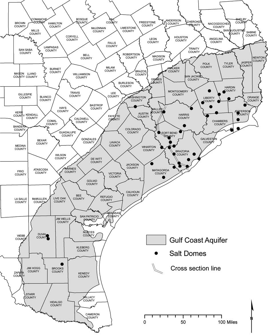 Map of shallow salt domes in the Gulf Coast aquifer in Texas. Also showing line of cross section in
Figure 12-2 (compiled from Seni and others, 1984b-d, 1985).
Hamlin concluded that evidence for dissolution of salt dome minerals in shallow groundwater is conclusive. Shallow salt domes extend well into the zone of freshwater and are surrounded laterally and vertically by Gulf Coast aquifer sands. As salt dissolves at the dome crest, an insoluble residue accumulates, forming the cap rock. Within the cap rock itself, chemical reactions occur that require the presence of low-temperature, low-salinity groundwaters (Kyle and Price, 1986). Geophysical logs have been used to identify high-salinity plumes within otherwise freshwater sands near several Gulf Coast salt domes and to map actual sand/dome contacts (Figure 12-7). Indeed, dissolution of salt domes by groundwater has been documented, and the amount of salt removed has been quantified (Seni and Jackson, 1984; Bruno and Hanor, 2003).
Although salt actively goes into solution at the crests of shallow salt domes, most of the high-salinity groundwater thus formed flows downward driven by density gradients. Recent studies document downward flow along salt-dome flanks and the control of faults and sand distribution on flow paths (Banga and others, 2002; Bruno and Hanor, 2003). Although upward flow occurs in deep zones below the base of freshwater (Evans and others, 1991), upward movement and mixing of dense saline groundwater from deep zones into the low-density freshwater zones appears unlikely.
Development of both fresh groundwater and salt-dome resources has increased the potential for contamination of shallow aquifers. In pre-development steady-state groundwater flow systems, salt-dome related contamination remained localized by high freshwater heads in surrounding sands and the tendency for high-density brines to flow downward. The combination of lowered heads in the Gulf Coast aquifer and increased heads in cap rocks has created hydraulic gradients directed outward from the salt dome toward adjacent freshwater sands. Resource extraction and leakage of stored petroleum product have further perturbed the natural system.
Most of the available evidence for salt-dome-related contamination of the Gulf Coast aquifer is at least 20 years old. More recent hydraulic and hydrochemical data, including data collected periodically through time, are needed for proper risk analysis and for a more comprehensive understanding of groundwater flow near salt domes.
Managed & Built by I2M Consulting, LLC | © 2010-
