

Huang submitted a Master's Thesis from the University of Houston in 2012 and reported therein that surface deformation has been an ongoing problem in the Houston Metropolitan area because of the city’s location in a passive margin where faulting and subsidence are common. According to previous studies the causes of the surface deformation are typically attributed to anthropogenic activities, mainly the subsurface withdrawals of oil, gas, and mostly groundwater.
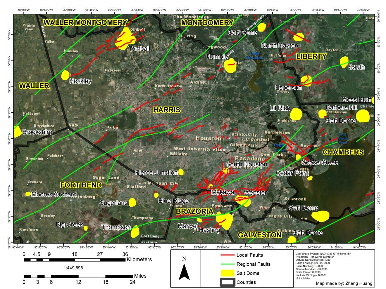
In the above figure, a map of the fauls and salt domes is shown for the Houston Metropolitan area within Harris County, Texas. The red lines represent local faults (Brown et al., 1974; Verbeek & Clanton, 1978; White & Morton, 1997; Engelkemeir & Khan, 2008) and the green lines represent regional faults (Ewing & Lopez, 1991). The yellow polygons represent Gulf Coast salt domes (Huffman et al., 2004).
However, the majority of the studies done have not accounted for the vast amount of salt underneath the Houston area and its role in the surface deformation. The objective of the author's study was to identify areas of surface deformation in the greater Houston area and their possible relationship with subsurface salt movements. To accomplish this, he integrated three kinds of data:
- GPS,
- LiDAR (Airborne and TLS), and
- Gravity.
GPS data revealed subsidence and uplift in Harris County. DEMs (is a raster or with digital value of the elevation at the given pixel. it is continuous data. LIDAR is laser remotely sensed data, is it laser returns, which are points with known x, y, z values, and other information) were generated from airborne LiDAR, which revealed changes between salt domes and their surrounding areas.
TLS data collected over the Pierce Junction site, chosen for accessibility and depth, revealed vertical changes over the surface above the salt dome. Gravity data acquired over Pierce Junction salt dome also revealed changes in the subsurface. Groundwater withdrawal may be a large influence in the surface deformation of the Houston area, but salt-related surface deformation should be more closely studied to quantify its influence.
Managed & Built by I2M Consulting, LLC | © 2010-
