

Click on the map or search for a location for more information. Source: NOAA, US Census, USDA
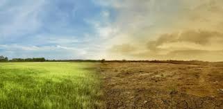 Feast or Famine
About this App
The Drought Aware app is intended to provide the latest information about current, future, and historical drought conditions in the United States. The data shown here from ArcGIS Living Atlas are authoritative U.S. government sources, including:
- NOAA NIDIS US Drought Monitor. Their website provides regional summaries of causation and impact;
- NOAA Climate Prediction Center Monthly and Seasonal Drought Outlooks;
- The USDA 2017 Census of Agriculture for agricultural values and employment; and
- U.S. Census American Community Survey for state and county population totals for the past year
Drought Definitions
Abnormally Dry (D0)
Going into drought there is short-term dryness slowing planting, growth of crops or pastures.
Coming out of drought there is some lingering water deficits; pastures or crops not fully recovered.
Moderate Drought (D1)
Some damage to crops and pastures
Streams, reservoirs, or wells low, some water shortages developing or imminent
Voluntary water-use restrictions requested
Severe Drought (D2)
Crop or pasture losses likely
Water shortages common
Water restrictions imposed
Extreme Drought (D3)
Major crop/pasture losses
Widespread water shortages or restrictions
Exceptional Drought (D4)
Exceptional and widespread crop/pasture losses
Shortages of water in reservoirs, streams, and wells creating water emergencies
Use this App
Click a location in the U.S. to see the current Drought Monitor information and potential impacts. These values can be viewed by county or state totals from the selector at the bottom left.
Agriculture summaries are based on the USDA’s 2017 Census of Agriculture and are the best available data (though not all areas report data). Highlighted are some of the most economically important yet drought sensitive products.
The time series graph will change the display of the Drought Monitor map, however, all of the other values (outlooks, agriculture, etc) are fixed in time.
Use the mouse wheel to zoom in and out of the time series graph.
A blog describing some ways to use Drought Aware can be found here.
This app was designed by Esri’s Dan Pisut, Emily Meriam, Caitlin Scopel, and Chris Mahlke . The source code for the app can be found on GitHub. For questions, please contact environment@esri.com.
Managed & Built by I2M Consulting, LLC | © 2010-
